Posts

Showing posts from February, 2018

New Ipswich Community Page

Image
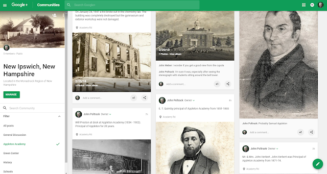
I never intended for my blog to be dedicated to a single topic. When I undertook the task of scanning photos for the New Ipswich Historical Society and posting them, I realized it was headed in that direction. I've created a separate Google Community page named New Ipswich, New Hampshire which will eventually contain all my postings related to the town of New Ipswich, but organized around topics using filters (see screenshot below). It supports commenting. This blog, the communities, collections, photos and more can all be found on my website poltrack.net . Just one more thing... The Green Center will be open March 3, 2018 Screenshot of filter capability for communities

Schoolhouse #5 - Smithville

Image
Schoolhouse #5 was located in Smithville and was closed in 1931. The teacher was Edna Martinson. The building was first sold in 1944. The exterior is remarkably unchanged  except for extra windows and removal of the side door. I've been processing many more photos than have been shared via this blog. You can see them on my New Ipswich History Collection or Website Page . Schoolhouse #5 Former Schoolhouse #5 is now a private residence Photo taken Apr 9, 2014 - John M Poltrack

Highbridge School - New Ipswich, NH

Image
I'm working with a folder of photos from the New Ipswich Historical Society that is a bit more organized than my previous work. These are photos of the many school house that existed throughout the town. The first photo is labeled "School House at High Bridge".  Bert Eaton was the teacher. The photo was donated by Archie Eaton. The building is now the residence of Dave Barry and is located across from Warwick Mills. I've included a Google Mapview. Note the boy on the far left without shoes. NIHS catalog 92.508 Photo taken by F. W. Brooks, Nashua, NH It only seemed right to include a photo of the NEW Highbridge Elementary School which is located just up the hill. Opening day at Highbridge Elementary School Nov 19, 2011 Photo by John M Poltrack

Stearns-Cummings House

Image
Readers of this blog and my New Ipswich History Collection have been most helpful with identification of the buildings shown in photographs from the New Ipswich Historical Society. Matthew Kangas identified this house from the last two photos and the description in the National Register matches the photos (see below). Photo taken Feb 4, 2017 John M Poltrack NIHS catalog 97.64 NIHS catalog 97.65 #94 Steams-Cummings House, c.1790 (Main Street) - Contributing Building This late 18th century woodframe cape is the first structure on the south side of Main Street after it makes its sharp turn to the southwest on its way to Smith Village. The main house sits on a granite block foundation, and is shaded by two large hemlocks. Photographs show that the center doorway originally had a paneled door with flat trim; the Greek Revival style surround with flat trim and molding and corner blocks with pateras and the partial sidelights with recessed panels b

Tabraham House at Bank Village

Image
In 2011 I was given a tour of this home in Bank Village. At that time the person living there asked me to photograph the grounds and interior. She was hoping to host a house party for Joe Biden as she had done in 2007 (in New Ipswich). The photos were going to be provided to the Secret Service so they could assess the security of the venue because in 2011 Biden was Vice President. Sadly the party never happened, but I did get a chance to learn about this beautiful home.  The New Ipswich Historical Society has a number of early photos of the property including some when it had a wrap around porch. It is known as the Tabraham House. Photo John M Poltrack Feb 2018 NHIS catalog 97.398 Barrett-Thompson-Tabraham House NHIS glass negative One of my photos taken June 15.2011 NIHS catalog 92.282 circa 1929 NIHS catalog 92.280 circa 1929

The Former Mary Mansfield Home

Image
I assumed that the Old Town Hall was the lone building situated at the intersection of Main, Preston and Willard Road across the Street from the Congregational Church. However I discovered a photo that dispels that belief (see last photo). The Old Town Hall built in 1812 Photo taken Jan 22, 2011 by John M Poltrack Early Postcard of the Town Hall given to the New Ipswich Historical Society by Steven Packard NIHS catalog 92.223 This Google Street View shows that there is not much open space between the road and the Old Town Hall.  However at one time Mary's house was situated in that empty spot.  Photo below shows the Mary Mansfield House. Mary was the grandmother of Mrs. Balch. The house was torn down by Ms. Phillip Gordon. The photo was taken by Leon R. Willard and donated by Mrs. Allen Balch.

The Willow Arch

Image
River Road is a nice place to walk. There is a lot of traffic but visibility is good and the road is wide enough  for walkers. If you are lucky you might see an eagle on the river. It must have been amazing when these photos were taken. Postcard NIHS catalog 92.344 Mrs. Myron Taylor & Phillip Taylor at the Willow Arch NIHS catalog 92.346

W. Johnson Store in Bank Village

Image
I came across some badly faded photos in the Historical Society's collection that were taken by H.J. Moore in September of 1895. Photography was a chemical process and time was not kind to this photo. Photo taken by H.J. Moore on Sept. 20, 1895 NIHS catalog 97.25 I'm not very proficient with Photoshop but achieved some success by adjusting the levels of the histogram. I narrowed the range and placed the center point under the peak, using the sliders. Editing levels in Photoshop After processing a bit more detail is visible. I wonder why this photo was taken. Certainly not as an example of proper foundation construction. Processed photo after adjusting levels and saturation This photo was taken at the same time. I suspect that these buildings are a rear view of what was a store located in Bank Village. Photo taken by H. J. Moore Sept 20, 1895 NIHS catalog 97.24 I wonder if this photo which appears to be taken at a later date, shows the front

The Whirlpool Bridge

Image
 I've always been curious about an unused road that runs from the back of the New Ipswich Congregational Church to River Road in Bank Village. It has the curious name "Whirlpool Road". Apparently it was named for a natural whirlpool in the Souhegan River caused by the flow around a bend. Google Maps (below) shows a feature called "The Whirlpool". Zoom in if you can not see it. Among the collection of photos I found one labeled "Whirlpool Bridge". It is a beautiful structure. The photo is undated. The Whirlpool Bridge NIHS catalog 98.110

Swimming at Bankie

Image
During the mid 1970s we used to go swimming at the beach  in Bank Village. It was private property but they allowed locals to use it. Sadly that ended when litter and broken glass appeared. Once again a few ruined it for the majority. This photo was taken circa 1900 by Myron Taylor and given to the New Ipswich Historical Society in 1980. The Country Club can be seen in the background on the top of the hill. In the photo C. Ralph Taylor is second from left and Phillip Taylor is center front. Note the changing rooms and outhouse. The photo was donated by Sylvania T, Durfee in 1980. Bank Village Beach circa 1900 - NIHS catalog 92.262 To this day Bank Village remains popular as a place to take a dip. Lots of folks jump off the bridge on Old Country Road. A closer view of the Country Club on top of the hill. Why is that guy on the roof? Souhegan Country Club circa 1900 - NIHS catalog 92.245

Horseback Riding on Turnpike and Main

Image
These photos were donated to the New Ipswich Historical Society by the James Barr Estate. I'm curious when this was taken. The corner store is still in existence and roads look unpaved. Saddle Up The photo quality of this print did not allow me to read the sign. The second word might be PUB. Off they go down Main Street

Willow Brook Tavern

Image
The Willow Brook Tavern must have been quite a place back in the day. It had a dance hall, cows, rose bushes, a vegetable garden. Other photos show folks on horseback. All these photos were donated to the New Ipswich Historical Society by the James Barr Estate. Willow Brook Tavern (renovated Clark Hotel). It eventually became the 1808 House Cow corral, Turnpike Road in background Left of the Tavern, chicken coop  A man and his cow The barn became a function room and dance hall The original barn The vegetable garden appears to be located where the Short Stop sandwich shop currently is located Another view of the building, library on left Extensive landscaping Climbing roses, library on left Rear of Clark Hotel before becoming the Willow Brook Tavern

Leading Lines

Image
The monthly photo theme for our photo club is Leading Lines. I'm not coming up with new ideas but  I found plenty in my archives. Here are a few. The Photo Club met at Connolly Brothers Dairy Farm in Temple, NH This is one of my "leading lines" photos from that shoot Garden Tour at the home of Ken Vengren and Harrison Kendall Garden Tour at the home of Ken Vengren and Harrison Kendall Hay Loft in New Ipswich, NH Cattle Stalls at the Hillsborough County Fair grounds in New Boston, NH Nice walk to White Ledges in Temple, NH Shadows lead the way at Shieling State Forest in Peterborough, NH Looking up at dead trees in a swamp in Townsend, MA Gritty walkway at Hopkinton Dam Autumn Farm Stand in Greenfield, NH